Services
Contact Info
General Questions or Issues Email - Citymanager@kingstonsprings-tn.gov
General Questions or Issues Phone Number - (615) 952-2110 Ext. 8
Technical or Software Issues Email - MWilson@apsu.edu
Technical or Software Issues Phone Number - (931) 221-7500
GIS Overview
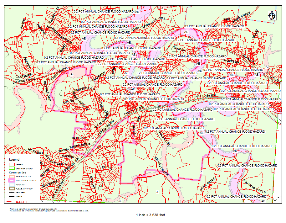
Kingston Springs FEMA Flood Zones
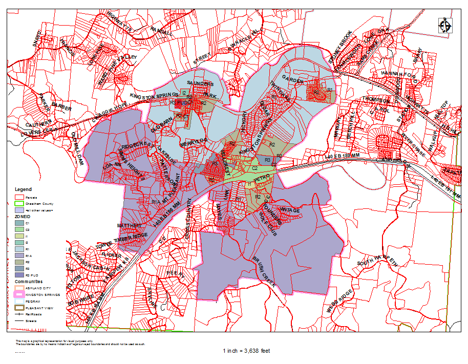
Kingston Springs Town Zoning Districts